Ongrad is a world of stark dualites. Long winters capable of raising water levels with frozen ice. The summers are hot enough to dry up rivers and parch lakes. Two continents complement each other as they swim in the 7 great seas. Flora adapted to heartyer to sustain the seasons, or weaker to die off waiting dormant beneath the frozen ground. Fauna developed to cope with days & nights lasting months.
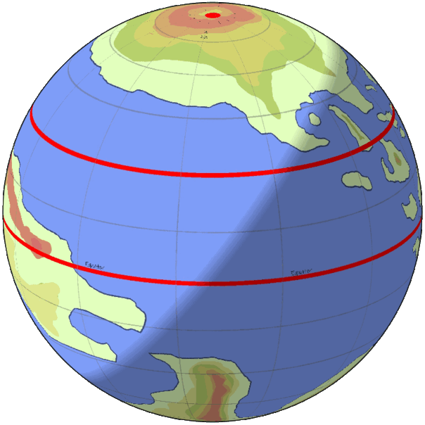
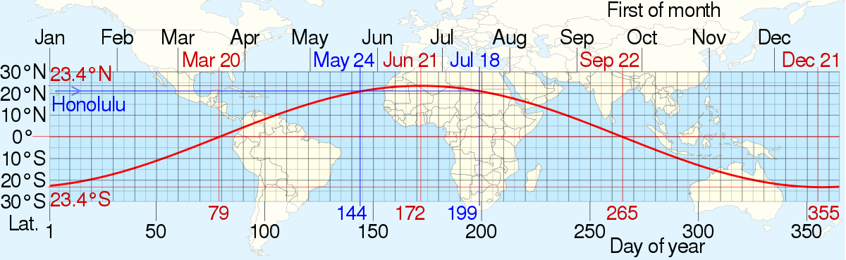
The subsolar point is the spot where the sun directly points at the earth. On earth the point at any given time is limited to a band near the equator shown by the graph below. Ongrad’s 90° tilt would cause the red line to hit every square mile. turning the map completely red as it slowly spirals up and down the planet. Everywhere on ongrad the daylight is unique, altered by its 90° angle. If the red line on a candy cane represents the spot with direct sunlight in earth, then Ongrad's proverbial red line would be squished so close together the cane would turn completely red.
At the north & south poles, a much different story is told during the year. The term solstice doesn’t really apply here because at the poles one day/night cycle lasts the entire year. The beginning of the year starts at the northern summer “solstice”. This marks the halfway point of the north’s long day. By this point the sun has been hitting that pole for just over a quarter of a year, and the southern pole has been in darkness for just under a quarter of a year. This will continue for another quarter until the equatorial equinox, for this short period the sun can be seen low on the horizon of both equators. For the south pole it’s the start of a long day, and for the north pole it's the beginning of a long night.
Moving north an equal distance away from the equator and poles would put you at latitude +45° here’s what would happen then. The days would be much longer than the nights. The sun would slowly bob up and down as the days went on, subsequently dipping lower and rising higher. Halfway to the first equinox the sun would reach a subsolar point creating a surreal effect that makes shadows disappear on some objects. During each equinox the nights will equal the days. After the first equinox the nights will continue to grow longer until the northern winter solstice. Now the nights will become shorter and shorter until the calendar resets and they continue the cycle.
Starting at the equator going outward you would see mostly normal days, aside from at the beginning and middle of the year. If you stood at the equator when the north and south poles are facing the sun directly you would see the sun just peak over a flat area that would last for about ___ days until the sun went back down. You would have shorter days until the equinox when the day would be the same time as the night. Following the equinox the days would get longer again until the solstice when the cycle would repeat.
Ongrad lies on a 90° angle in relation to its sun. Due to earth’s relatively close distance from our sun, a 90° angle would boil on one side of our hemisphere and freeze on the other. But an additional 70 million kilometers (210 km total) would increase the amount of C02 in the atmosphere enough to stabilize the the temperatures keeping them inside the range of 3 to 46 celsius. For simplicity sake I kept the orbiting star the same as our sun.
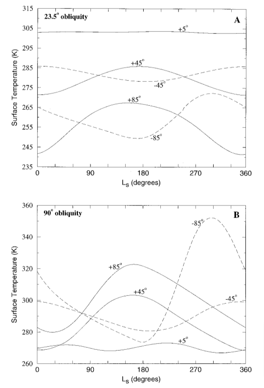
(Planetary position is based of off the above paper.)
Moving the planetary body so much farther away causes problems and changes on several different levels. First and foremost is the difference in how long the years last. According to Kepler's third law, the planetary body’s rotation speed around the sun relies almost entirely on its distance from the star. Increasing the distance by an extra third means that the previous 365 day year would turn into a 607 day year. I especially hated the idea of having such a long year because of the 90° angle my planet is on. In an ideal world I would have a much shorter year allowing for more dynamic and frequent season changes. To solve this problem I changed the planet's rotation speed at the equator from 1,670km/h to 1,628km/h, which combined with its larger size changed the day from 24 to 32 hours. Adding those hours causes the length of a year to decrease to 455.25 days in one year. The 32 hour day makes it seem like the year is shorter when the time it takes hasn’t actually changed at all. I loved this compromise because I didn’t break any actual physics rules (that I know of) and got a shorter year by tolerance stacking such a small percentage of a number decreasing the speed of the planet by 2.5%.
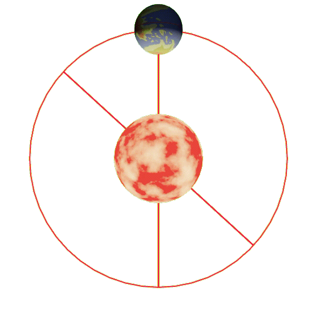
This is a gif shows how the seasons and day night cycle would play on the planet. The beginning of the year during the northern summer solstice (when the planet is directly below the sun in the graph). Because the story is set in the cradle continent I will use that region as a focus for this section.
This is the middle of summer for the cradle continent, the sun will be out a few days when the.
Because the science of the globe is not worked out the equator is commonly referred to as "the balance" since for most of the year the days are the same length as the nights. And the further you go from the balance on either side the more imbalanced the ratio become.
The globe is 1.3x larger than earth
The
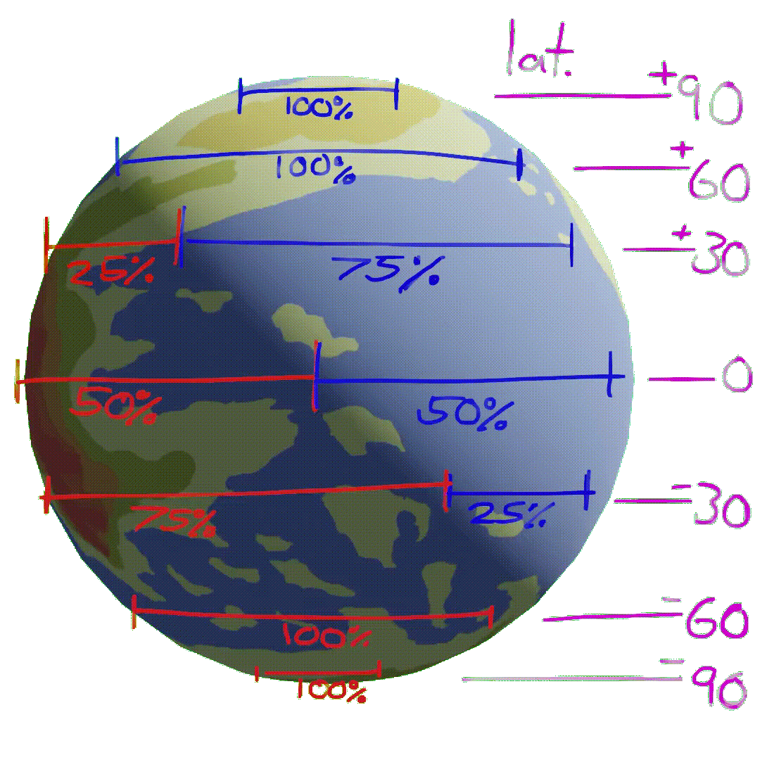
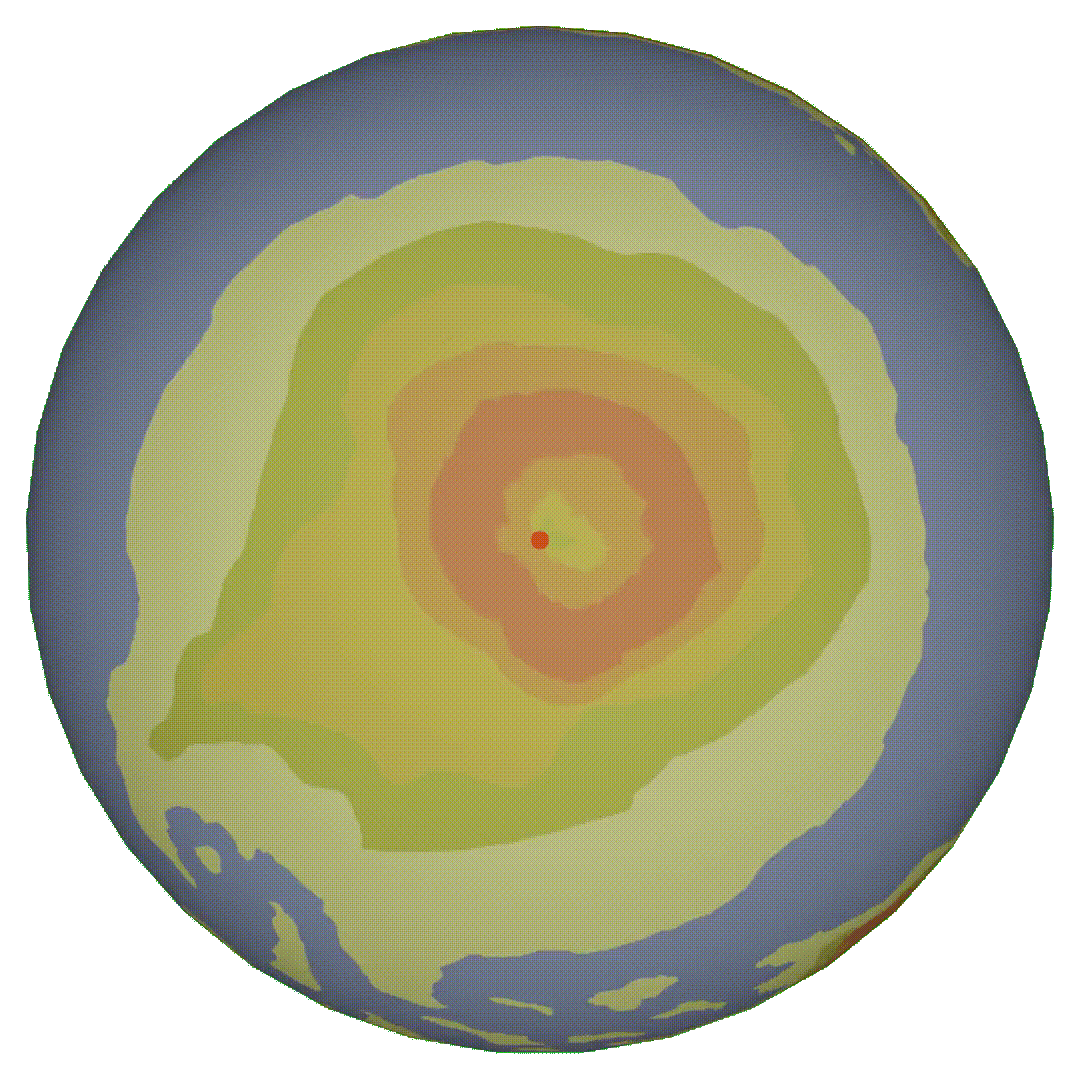
If you view the planet from an angle perpendicular to the orbital plane (as seen in the accompaying gif). The number of sunlight hours per day varies based on latitudinal location. Choose a point on the globe, draw a horizontal line across the globe at that latitude. The percent of the line in sunlight is the percent of the day that will have sunlight. Note that this graphic is a snapshot of a single day near the end of the year. In reality this shadow line is constantly changing as it slowly rotates around the planet during the year's cycle.
Note: Some areas are entirely covered in shadow or light, these areas are either dark or light for all 42 hours of the day.
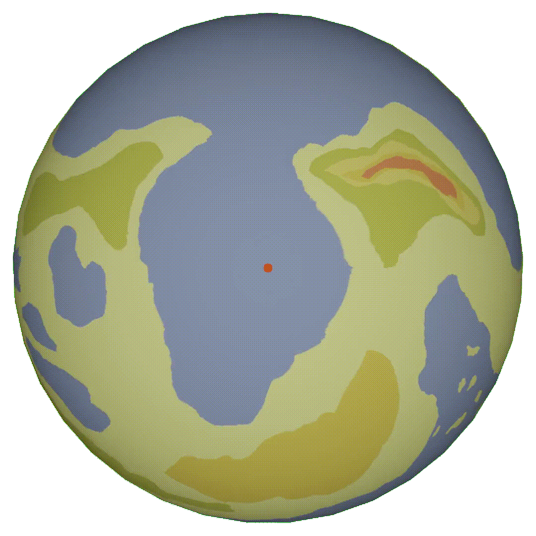
The north pole is a vast bay, as seen in the image above. In the extended winters, the ocean waters in the bay freeze from the complete lack of exposure to direct sunlight for several months prompts the formation of a substantial layer of ice. The bay freezes over and thickens enough to bear heavy weights. Conversely, in summer, the constant direct sunlight leads to the rapid melting of the thick ice layer and completes the thawing process within about three months. Mercantile ships often navigate these waters during the summer months but are either stored in expensive dry docks or docked outside of the bay for half the year. During the winter it is possible to traverse the ice from one side of the bay to the other. Note that the aforementioned ice is oceanic ice, not to be confused with glaciers which are on land. This is of particular importance as ice that is frozen in the ocean does not affect sea levels because its weight does not change and will displace the same amount of water as before freezing.
The South pole is very far away from our story, in fact only three named characters so far have ever been to the south pole: Cole, Esme, and Aesop. Esme and Aesop use a portal to travel to the continent and believe it to be another plane of existence e.g. a heaven or hell. Cole is in the opposite boat: she is from an island off the coast of the south continent and was teleported to the land where the story takes place. Since the pole is so drastically different from anywhere else on the planet. During the summer, heat radiating from the surface causes the air to rise which is replaced by cooler air over the ocean surrounding the continent. The ocean air coming in brings large amounts of rain, this combined with the excessive amount of sunlight creates flooding and massively stimulates the plant life.
Nearly all plants on the south pole continent are annual, meaning they die and need to be planted every year. The plants are generally all black as well which allows them to absorb more radiation faster since they are annual and wont be impacted by the sun's long term effects. These plants are ferocious and grow incredibly fast in to out complete their neighbors for sunlight. Once the long day begins to come to an end, the plants drop their hardy seeds for the next summer and die off. The amount of plant mass amassed during the time is staggering and when night finally comes plant detritus litters the continent's floor. Taking advantage of the situation are several species of mushrooms who feast on the near infinite amount of new nutrients. Some common species of mushrooms can grow up to 15 feet creating actually mushroom forests where their spores land. The mushrooms run out of food and die off a short time before the coming of the new day when the dormant seeds of the previous year's plants come to life and start the cycle a new.
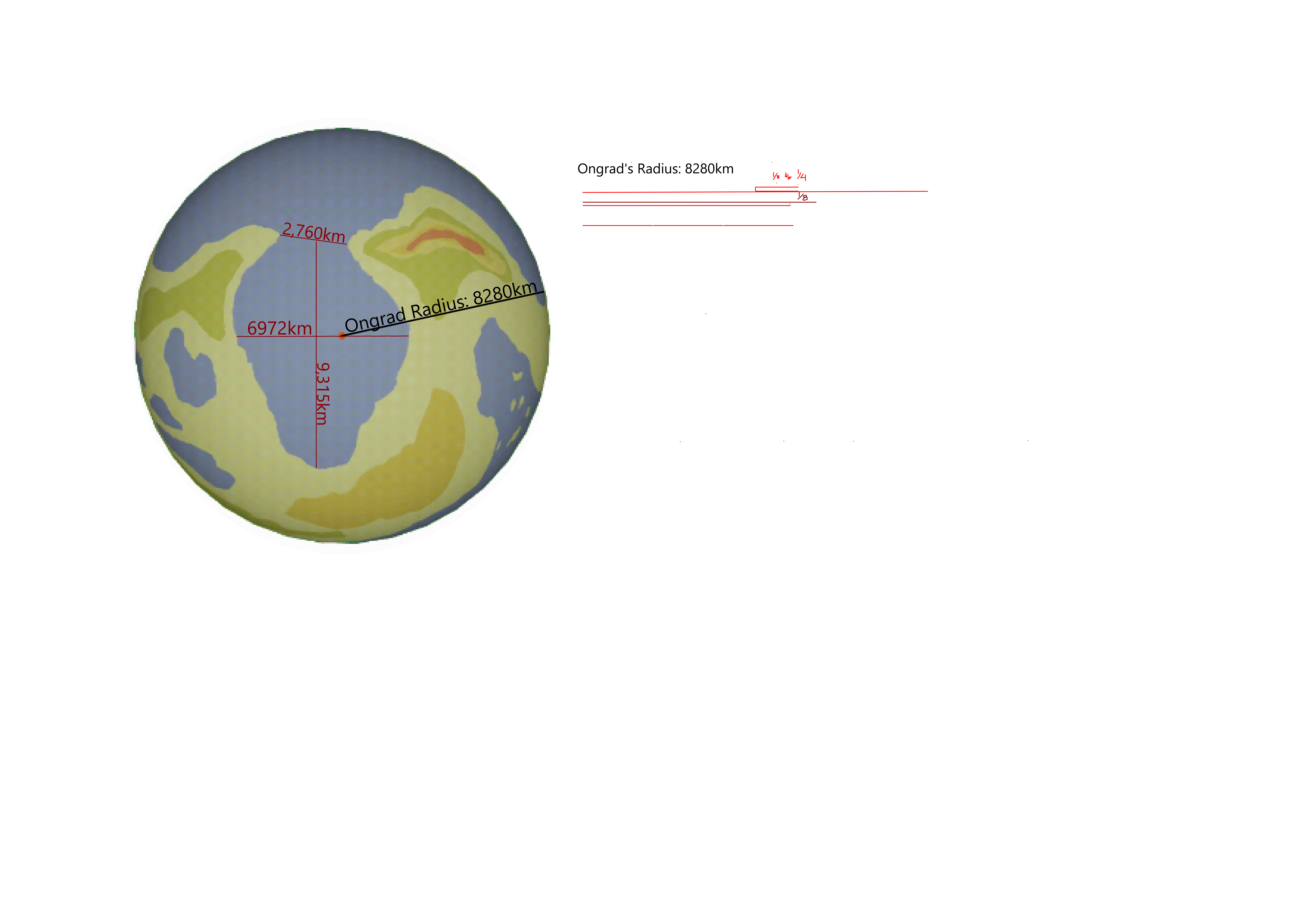
Ongrad has a radius of 8280km making it 1.3x larger than earth. The distance from one tip of the bay to the other is 2,760km. The greatest distance from one end of the bay to another near the center and 6972km away from one shore to the next. From the top of the bay to the bottom is 9,315km. The size of the planet was chosen because the days are 1.3x longer which means that a normal person will be able to travel similar distances on a large scale.
The comic begins in the north in the town of Weilheim, in the kingdom of Sunhold. Them move south then upriver, and into the mountains.
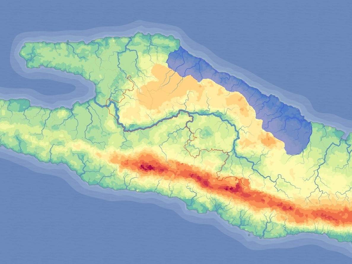
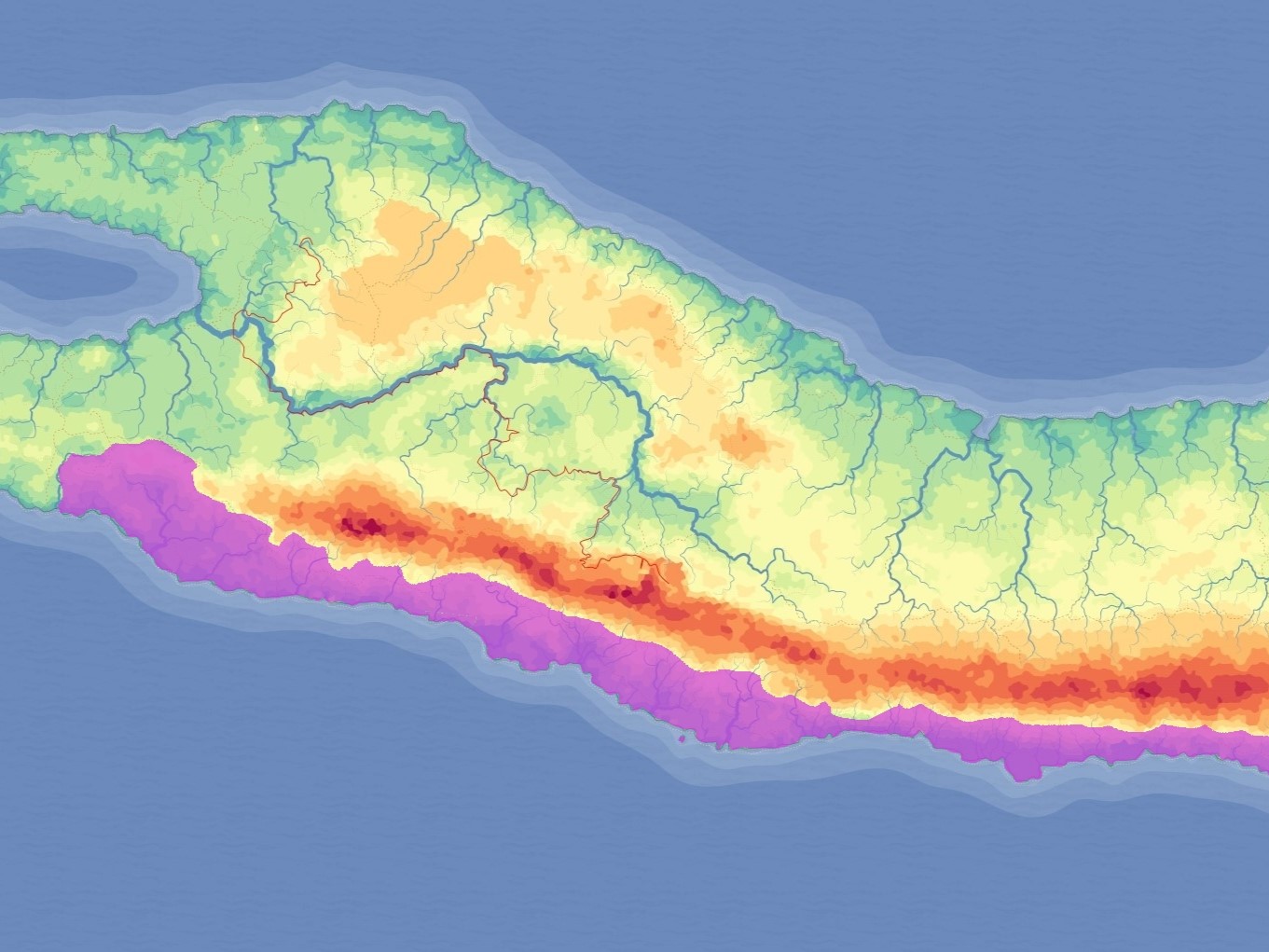
An estuary is where a river meets the ocean, the area is named after the estuary of the Grand River. The Estuary was originally home to a small dense mangrove that sprouted out of a delta. Dwarves funneled the river through a deep fast running drainage ditch killing the mangrove, making way for the creation of the Zmur. Zmur was built with Dwarven engineering to stand tall and proud, it's known as the moss city because of the green tinted stone found near and around the city which were used by the dwarves to create the foundations and many of the buildings. The brackish water is home to several port towns, the major of them Zmur. The city is a vital part to trading all throughout the cradle because it controls access to the Grand river. The southern portion of the map is populated by small deserts, grasslands, and woodlands.
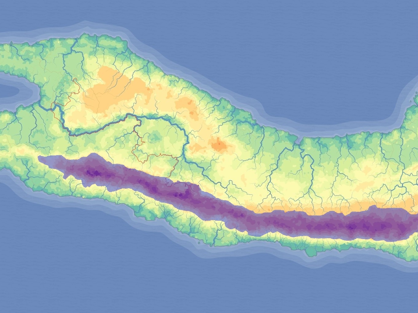
This area is based directly off the Andes mountains in south america. The dwarven range is formed from the subduction of an oceanic tectonic plate with the plate that makes up the continent. It has a very moist southern side near the ocean with little rainfall. And a much rainier northern side with a more gradual slope. Its name comes from the fact that the region is nearly entirely inhabited by dwarven civilization. Most of these cities are built where the water is on the windward (northern) side of the mountain range. Kendal is a dwarven city on the leeward (south) side of the mountain range. The dwarves of Kendal dug a tunnel through miles of mountain to get to a windward water source. The water runs through a duct and out the southern side of the mountain. This excess water created a gibrloading="lazy" altar delta which facilitates an area unique to the region with multiple endemic plant species.
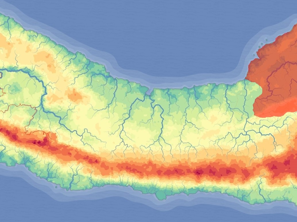
The far east is a naval empire, because of the natural barrier of the expanse not much contact is made. The population majority is human and bug, with a smaller but vital orc population that facilitates the building, and maintenance of great ocean vessels.
The north crust has a very small population for its size. It has very harsh conditions for growing crops. A gradual ocean slope from the land which makes the creation of harbor towns an impossibility for most of the shoreline. The inhabitants here have a stereotype of being drunk, fighting and not wearing clothes. Not a lot of continental trade occurs throughout the North Crust because of the lack of ports and the fact that they are mostly cut off from the rest of the world aside from the two entrances on the east and west. They have a lot of iron near the center of the region. It gets lots of rain and rivers because during the winter, the heavy air drops off most of its moisture on its way up the plateau.
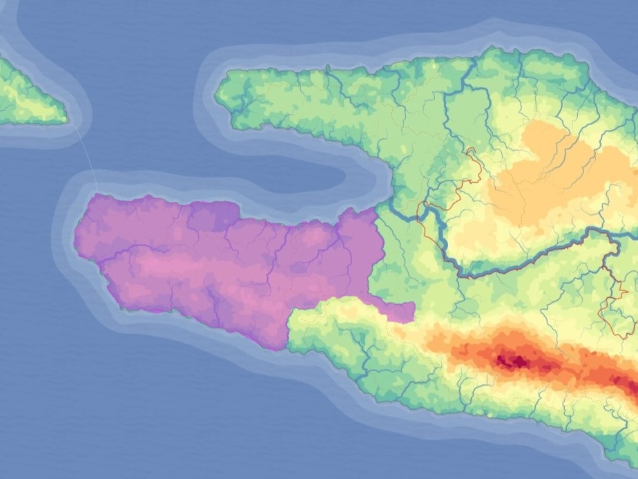
The South Crust is a very thin stretch of land with a very heavy orc population that thrives in the strange landscape. The amount of rainfall would land the southern crust's climate into a desert classification, but the moisture levels of the crust are exceptionally high due to the Dwarven mountain range. This caused the plants to evolve in a very unique way: rather than adapting to getting their moisture from the ground, the plants rely directly on the moist air itself for their water. These plants vary widely but generally have much weaker root systems, have soft leaves rather than waxy ones, and have much more surface area. One of these plants local exclusively to this area is a species of tree that lend themselves wonderfully to ocean vessels that the orc population use to their full advantage. Deep waters, majority orc population, & steep mountains immediately to the north make this area a very port heavy ocean oriented area. One notable distinct climate area are the two deltas formed from the diversion of major rivers into southern dwarven areas. They created great steady dams that deposit enough sediment to form two vast mangrove areas.
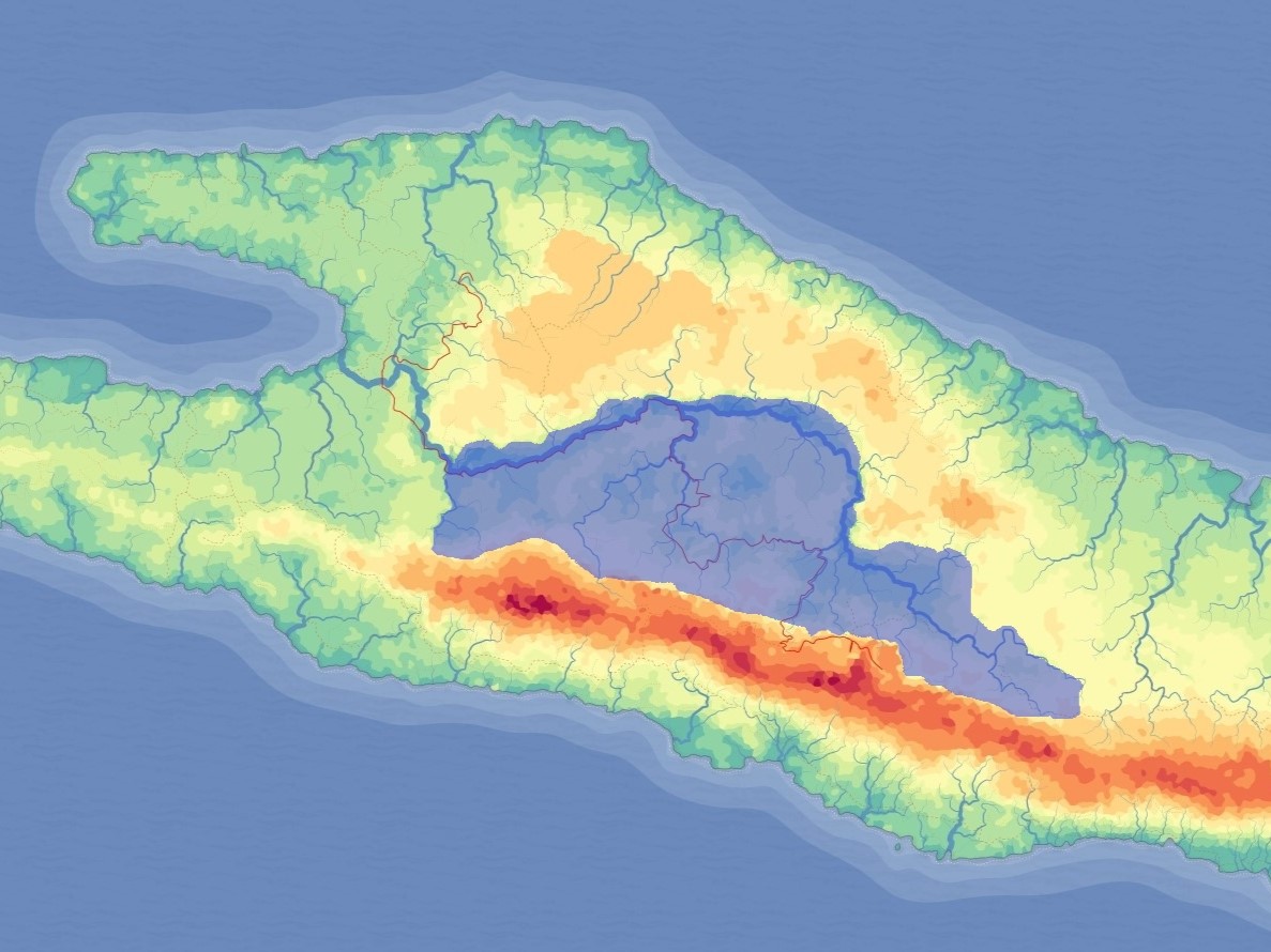
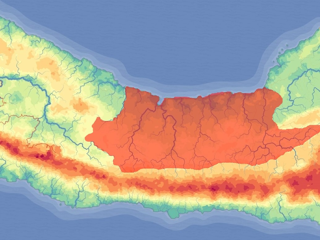
The Cradle Continent’s name comes from the large, central region that is surrounded by mountains on the north and south side. This area is the most densely populated on the Continent and is known as The Cradle for a few key reasons. The harsh wind and weather that comes in from the north sea is broken by the higher loading="lazy" altitude steppe before they reach the Cradle. Large enough clouds roll over the steppe and break in mountains south of the Cradle. These clouds provide the water that form many large rivers and carry nutrient rich sediment down from the mountain range and into the cradle. The southern mountains wall off all of the weather that would come from the south. Humans who are natural farmers thrive in this safe fertile environment. During the northern winter the moist air coming off the ocean is denser and doesn’t usually make its way over the plateau. However in the summer the air is less dense and the winds are much stronger allowing for plenty of rain to reach into and over the cradle.
The Expanse is the largest region, it has a large desert and. The roads are always in disrepair, constant rain turns them to mud and they don’t get serviced because the region is very disrupted by lots of fights and wars. It has a large bayou created by the river twins: sun & moon. The twilight bayou is mostly a freshwater bayou, with endemic species of fish, reptiles and amphibians.
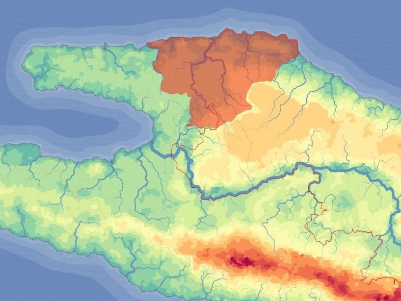
The north crust has a very small population for its size. It has very harsh conditions for growing crops. A gradual ocean slope from the land which makes the creation of harbor towns an impossibility for most of the shoreline. The inhabitants here have a stereotype of being drunk, fighting and not wearing clothes. Not a lot of continental trade occurs throughout the North Crust because of the lack of ports and the fact that they are mostly cut off from the rest of the world aside from the two entrances on the east and west. They have a lot of iron near the center of the region. It gets lots of rain and rivers because during the winter, the heavy air drops off most of its moisture on its way up the plateau.
The desert is home to a Palmato Gecko-esk god with six legs. One eye on the top of his head and he peeps out into the desert. black tongue It lives under the sand (near or in the eye of the sahara). About 20 feet in length (tail included) It wriggles under the sand causing tremors. When it enters the world above it does its eye first, by opening its eye in the sand. He lives in an underground spot where there is always a small stream of sand trickling down like an hourglass, and there's another pit that nobody goes down. Mad scientist gecko that needs the oil to de-stick his hands
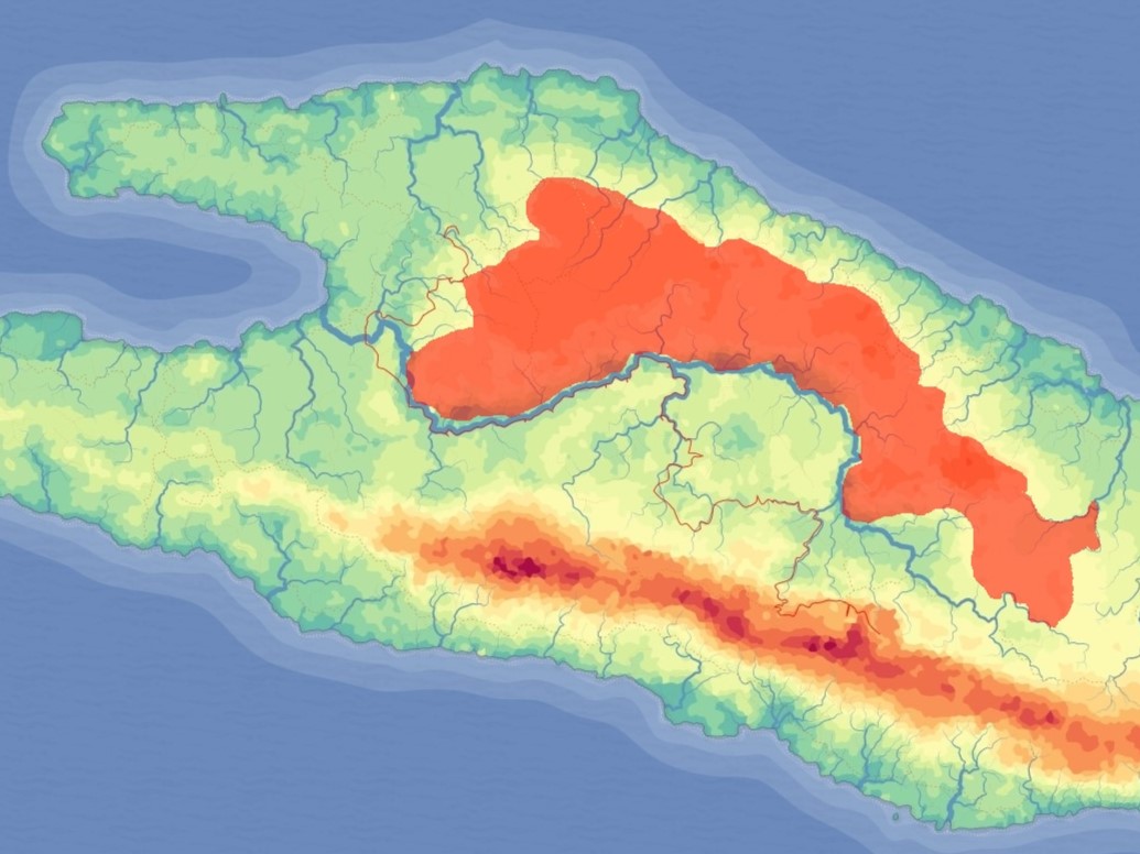
The Plateau is home to a majority bug population who live in tunnel networks that span large portions of the Plateau. The high elevation of the Plateau causes it to have a much colder climate than the surrounding lowlands. This temperature gradient creates a strong pressure gradient that affects atmospheric circulation patterns. The plateau's elevation also causes moist air to rise and cool, which can cause precipitation to fall in nearby areas as the air moves towards the center of the low-pressure area and lifts upwards. However, the plateau also creates a barrier that can prevent the denser, moisture rich air from reaching the Cradle, causing the region to be more dry than it normally would be. During the northern summer, warm, moist air from the Gulf Ocean flows over the plateau, causing the heavy rains south of the Plateau.
The North Peninsula has harsh weather and is not generally conducive to farming which causes it to have a smaller, more spread out population. It has three kingdoms: Arhyew, Mad, Guanesia, and the Winia Coast. The peninsula’s northern border is the Gulf Ocean, which has few ports because of bad weather and little protection for ships. The direction of the shoreline means that wind and weather will enter gulfs unbroken by land. The southern and western shorelines lend themselves wonderfully to shorelines filled with ports. The ports have safety provided by the land as well as incredibly fast currents that alternate their direction once per year.